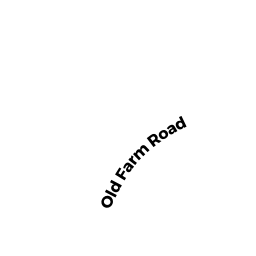
363 OLD FARM ROAD
Owner Information
MCGRATH JOSEPH V JR & JEANNE A
363 OLD FARM ROAD
HANOVER, MA 02339


Property Details
363 OLD FARM ROAD is classified as a Single Family Residential (Colonial).
The primary structure on this property was built in 1984. There are 4,050ft2 of built area within this property. There is 2,420ft2 of residential/living space within this property. This property is listed as having 7 rooms.
363 OLD FARM ROAD is valued at $606,200. The land is valued at $246,200 and the structures are valued at $356,400. There is an additional valuation of $3,600 on this property.
The most recent deed for 363 OLD FARM ROAD is recorded at the local registrar in Book 20727, Page 291. 363 OLD FARM ROAD was last sold on Friday, October 19, 2001 for $420,000.
Assessment data from fiscal year 2022.
Flood Data
According to the FEMA National Flood Hazard Layer, this property does not appear to be in a flood zone. It may also be in an area not yet reviewed. Nonetheless, confirm this information prior to taking any action.
To view the flood hazards around this property, create a FEMA "Firmette" Map of the area around 363 OLD FARM ROAD.
Broadband Internet Providers
| Provider | Type | Bandwidth (mbps) | |
|---|---|---|---|
| Verizon New England Inc. | Fiber | 940 | 880 |
| GCI Communication Corp. | Satellite | 0 | 0 |
| Viasat Inc | Satellite | 100 | 3 |
| HughesNet | Satellite | 25 | 3 |
| Verizon New England Inc. | DSL | 5 | 0 |
| Comcast | Cable | 1000 | 35 |
| T-Mobile | Fixed Wireless | 25 | 3 |
| VSAT Systems, LLC. | Satellite | 2 | 1 |
Broadband service provider data from December 2020.
Adjacent Properties
- 50 LONGWATER DRIVE
Single Family Residential owned by CHIAPPINI EDWARD & JEANNINE TBE - 40 LONGWATER DRIVE
Single Family Residential owned by MAMBRO CHERYL T - 351 OLD FARM ROAD
Single Family Residential owned by ROBINSON DAVID J & MARLA E - 375 OLD FARM ROAD
Single Family Residential owned by ZAYLOR PAUL R & CONSTANCE